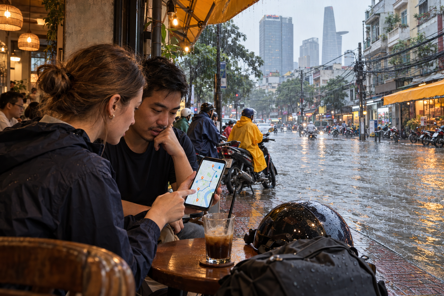
You finish a meeting, pack your laptop and look outside. The afternoon rain has eased, and your phone says home is twenty minutes away. Then a colleague sends a photograph of the junction along your usual route. Motorbikes are turning back. Water covers the road.
For anyone living or running a business in Ho Chi Minh City, this is where checking the weather becomes checking whether you can actually get home.
A forecast tells you rain is coming. Recent traffic camera images, local warnings and a careful route check help you decide what to do about it.
When is Saigon’s rainy season?
Ho Chi Minh City’s rainy season generally runs from May to November. Afternoon downpours are a familiar feature, although the season’s timing and the distribution of rainfall vary.
The pattern in 2026 shows why familiar expectations are not enough. At Tan Son Hoa station, September rainfall rose 48% above the long-term average after an unusually dry June to August. Rainfall from 1 September to 6 October reached the highest level for that period in the station’s record since 1980. Conditions still differed between neighbourhoods.
El Niño generally favours reduced rainfall in southern Vietnam, but individual extreme downpours depend on interacting weather systems. Recent flooding also coincided with high tides that restricted drainage. A relatively dry stretch can therefore be followed by a disruptive burst of rain.
Which roads in Ho Chi Minh City are more vulnerable to flooding?
Low ground, riverside streets, underpasses and places with poor drainage deserve particular attention. Rainfall and high tides can create different problems, sometimes along the same journey.
On 10 October 2026, Ho Chi Minh City traffic police published a warning covering 122 flood risk locations, distinguishing 83 associated with heavy rain and inadequate drainage from 39 associated with high tides.
Examples relevant to everyday journeys include:
Area or familiar location
Road sections to check
Thao Dien and the former District 2 area
Thao Dien–Quoc Huong junction and Nguyen Van Huong Street
Former District 7 area
Tran Xuan Soan between Huynh Tan Phat and Lam Van Ben; Huynh Tan Phat at Pham Huu Lau
Nha Be and the southern approaches
Le Van Luong through Nha Be; Nguyen Binh between Huynh Tan Phat and Muong Chuoi Bridge
Former Binh Thanh area
Ung Van Khiem between Nguyen Gia Tri and Dien Bien Phu; the Thanh Da housing area’s Block F embankment
Low points around major roads
Ben Cat Bridge underpass and sections below the Binh Phuoc flyover
These are risk locations, not a live list of roads currently underwater. Familiar former district names are used here to help readers recognise the areas.
Avoid judging an entire neighbourhood from its reputation. The relevant question is whether your particular junction, access road or building entrance is affected today.
1. TTGT Tp Ho Chi Minh: check cameras and local warnings
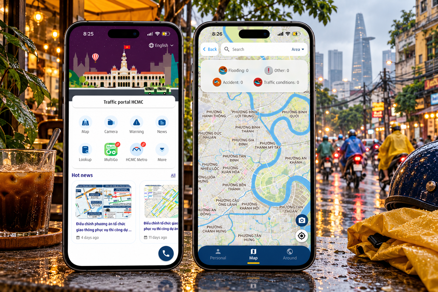
The TTGT Tp Ho Chi Minh app adds a visual check through traffic cameras, alongside local traffic information and community reports. A browser version is available at thongtingiaothong.vn.
There are two useful checks.
First, inspect the cameras along your route.
Open the app and select the camera section.
Search for the road or area, or move and zoom the map.
Select a camera near the junction you need to pass.
Inspect the image and check its displayed time, where available.
The cameras provide periodically refreshed still images. Treat the image as a view of one location at one time. It cannot confirm conditions around the next corner.
Second, look for warnings.
Open the warnings section and select relevant map markers to read their details. These can include alerts for flooding and congestion. Labels and screen layouts may vary between versions.
Check cameras near your departure point, likely bottlenecks and your destination’s access road.
If a camera does not load, shows an old image or points away from the affected lane, seek another recent source. Missing information should prompt another check.
2. Google Maps: look for flood alerts, then compare routes
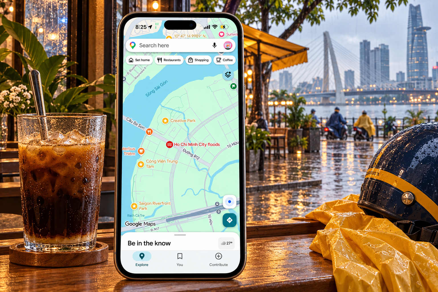
You may already open Google Maps before leaving work. During a flooding event, it can also display a flood alert directly on the map, giving you another reason to check before starting the journey.
A red circular icon with white wavy lines, sometimes accompanied by a label such as “Ho Chi Minh City floods,” can identify a flood-related crisis alert. This is different from the red lines showing slow traffic.
To check:
Open Google Maps and move the map to the area you plan to travel through.
Look for a flood icon or an alert card, if one is available.
Tap it to open the event information. Read the description and any available updates or safety guidance.
Enter your destination, compare routes and check whether your journey approaches an affected area.
Confirm uncertain road sections with recent TTGT images or someone at the destination.
The position of a citywide flood alert should not be read as a precise boundary or proof that the road underneath the icon is flooded. Read its details to understand what area and event it describes. Alerts are not shown for every flood or on every journey.
Google Maps also supports user reports of flooded roads in supported locations and app versions. These road reports are separate from broader crisis alerts and depend on information being submitted and updated.
The traffic layer remains useful for spotting congestion. Green, orange and red lines describe traffic flow, rather than water depth. A road without a warning or traffic delay still needs checking if you have other evidence of flooding.
Use the map to identify warnings and compare options, then choose a route based on the most recent information available. Follow road closures and traffic officers’ directions even if the app suggests continuing.
3. UDI Maps: check local flood information
UDI Maps was developed by Ho Chi Minh City Urban Drainage Company to help residents check flooding across the city. Its listed features include rainfall, high tides, flood locations and warnings, alongside information to help users consider alternative routes. It also allows people to submit observations and photographs.
For someone planning an evening commute, its value is bringing flood-related information into one place. Before setting off, check the streets around your home, workplace and any low points along the journey.
To use it:
Search for UDI Maps in Google Play or the App Store and check the app identity before installing.
Open the app and allow location access if you want to centre the map on your position.
Select the current conditions view and browse the area you need.
Tap available flood markers to inspect their details and photographs, where provided.
Check how recent the information is before using it to plan your journey.
Before relying on UDI Maps, check whether the flood information shown is recent. If the app does not load or its reports appear outdated, use TTGT cameras and Google Maps alerts to cross-check your route. An empty map does not establish that nearby roads are dry.
A practical check before you leave
Imagine travelling from an office in the centre to a home in Thao Dien after heavy rain. Your usual route looks manageable in Google Maps, but a recent local warning concerns the junction near your building.
Rather than checking only the main road, work through the whole journey:
Read the latest local weather and tide warnings.
Check available TTGT cameras around likely bottlenecks.
Look for Google Maps flood alerts and compare possible routes.
Ask building reception, a colleague or someone at your destination for a recent observation of the final approach.
Check when a photograph or message was posted and which exact street it shows. A picture from yesterday, or another part of the city, cannot settle today’s decision.
If the final approach is flooded, consider postponing the trip or waiting somewhere safe. An alternative route is useful only if it actually avoids the affected section.
When waiting is the safer decision
Flooding is only part of the risk during a severe storm. Lightning, strong gusts and falling branches can also make travel dangerous. A fatal falling branch incident on An Duong Vuong Street in September 2026 was a reminder that built-up areas also have overhead hazards.
If thunder and strong winds develop, seek shelter inside a substantial building. An enclosed, hard-topped vehicle can also provide lightning protection. A tree, roadside umbrella or open shelter is not an adequate substitute. Remain sheltered for at least thirty minutes after the last thunder.
Avoid entering flooded roads on foot, by motorbike or by car. Water can conceal damaged surfaces, debris and electrical hazards, while its depth and movement can change quickly. Follow barriers and official diversions.
Being able to see another vehicle crossing does not establish that the crossing is safe for you. If you are unsure, stop at a safe location and reassess instead of testing the water.
What this means for small business owners
For a small business, a flooded commute can affect opening hours, deliveries, customer appointments and the person carrying the day’s documents.
A simple rainy-day arrangement helps. Agree who will check local conditions, how staff will report delays and when an appointment can move online. Give delivery partners room to postpone or change an approach when roads are affected.
Keep paper records, stock and portable equipment above floor level where premises may be exposed. Ask building management how basement parking and access are handled during heavy rain. Keep important digital documents backed up so that a delayed journey does not also become a lost working day.
If you are choosing a shop, office or apartment, ask about the entrance and access roads as well as the unit itself. A comfortable space upstairs may still be difficult to reach.
Before the next heavy downpour, bookmark the traffic portal, locate cameras around your regular journeys and agree a flexible plan with the people who depend on your arrival. When the sky changes, you will already know where to look.
Frequently asked questions
Start with TTGT Tp Ho Chi Minh to inspect traffic cameras and local warnings along your route. Then check Google Maps for available flood alerts and compare alternative routes. UDI Maps can provide another source of local flood information, but check whether its reports are recent. Include your destination’s entrance and access roads in your checks.
Google Maps can display flood alerts, including a red circular icon with white wavy lines. Tap the icon or alert card to read the event details. A broader flood alert does not confirm that every nearby street is underwater. Red traffic lines have a different meaning: they indicate slow traffic, rather than flood depth.
Low-lying streets, riverside areas, underpasses and locations with poor drainage deserve particular attention. Examples include parts of Thao Dien, the former District 7 area, Nha Be and Thanh Da. Conditions vary between streets, so check the specific road sections you need rather than assuming an entire neighbourhood is flooded.
Ho Chi Minh City’s rainy season generally runs from May to November, with afternoon and evening downpours common. Rainfall varies between neighbourhoods and from year to year. High tides can also contribute to flooding, so the rain stopping does not necessarily mean your route is clear.
Avoid entering floodwater on foot, by motorbike or by car. Check recent camera images, local warnings and alternative routes, while following road closures and traffic officers’ instructions. If conditions remain uncertain, postpone the journey or wait inside a substantial building. Another vehicle crossing successfully does not establish that the road is safe for you.
Share article
Easytiger Match
Find the right professional
1Tell us what you need
2We shortlist professional(s) and introduce them to you